Un-Ordinary Otways
(for more information about the non-railway related portions of this holiday, see the Jims Life Log version of this post)
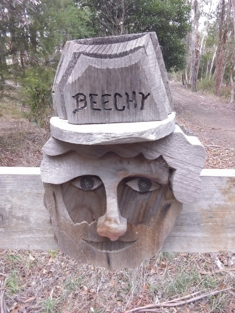
The Old Beechy, Tuesday 29/03
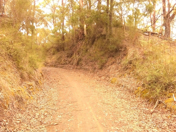
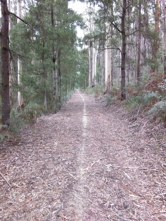
Tuesday. Holidays. Autumn. Put all those together, and there’s a good chance I will have been bike riding as part of a cycling holiday. For quiote a while I have wanted to do some cycling in the Otway Ranges in south western Victoria, Australia. And so as we attended a church camp at Elmore north of Bendigo over Easter and I would be roughly half way to the Otways I thought that would be a good opportunity to continue to the Otways after the church camp had finished. The venue for the ride today was the “Old Beechy Rail Trail”, or part thereof. I drove to Gellibrand and tackled the climb up to Beech Forest on a 20” K-Rock foldable bike. I wasn’t sure how the bike might handle the sorts of rides I had planned for the holiday, but it handled everything the trail threw at it.

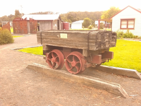
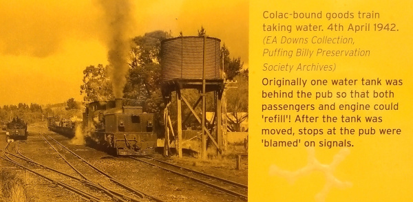
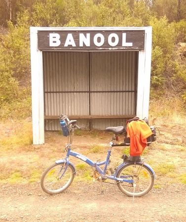
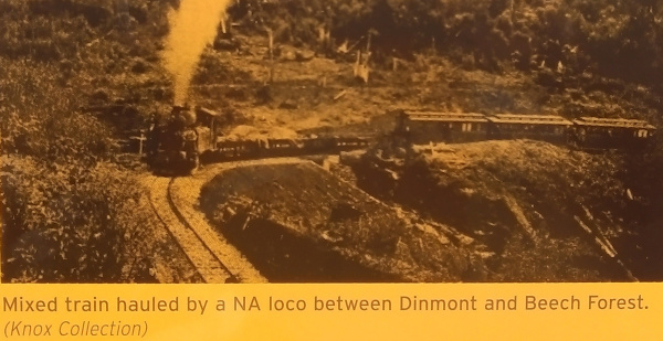
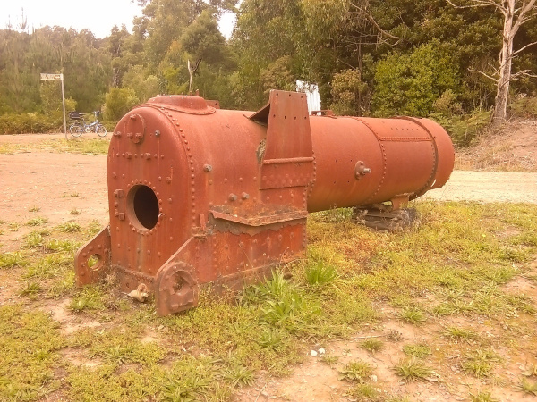
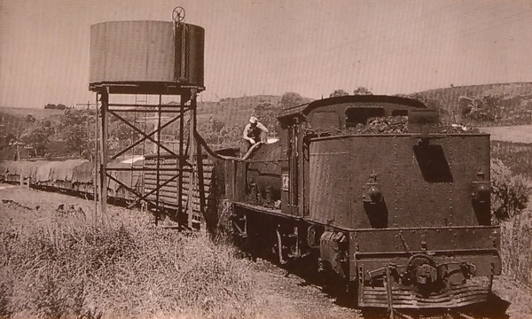
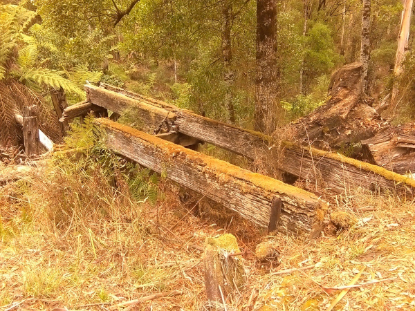
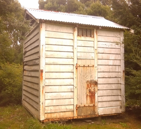
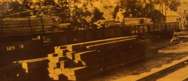
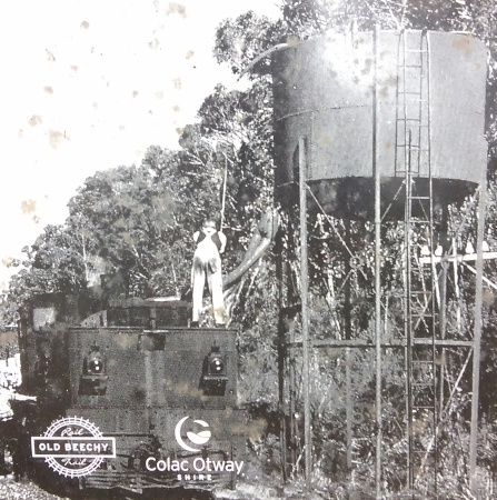
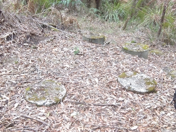
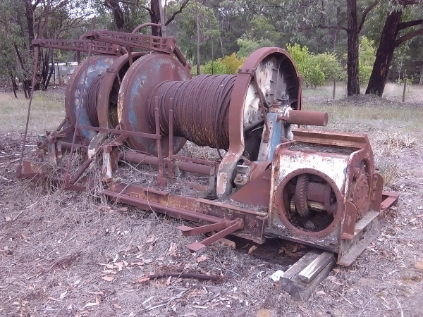
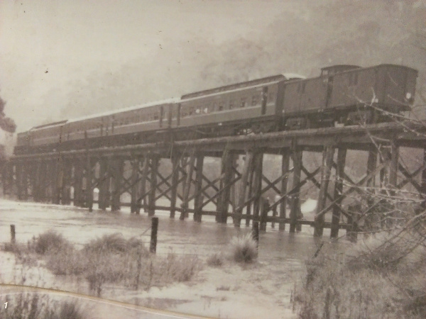
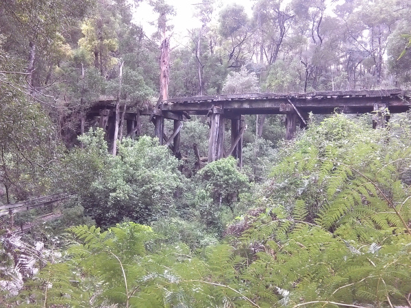
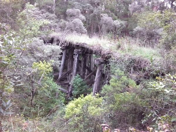
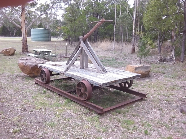
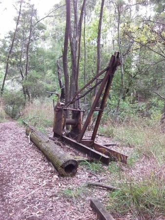
The ride I did today was along the right-of-way of a long disused 2” 6′ guage railway which originally ran from Colac, in the south western region of Victoria, Australia, to Beech Forest, and then was later extended to Crowes. The maximum speed of the trains on the line was 32kph / 20mph, but normally between 16kph / 10mph and 24kph / 15mph was the norm. And interestingly I averaged not much less to what a heavy train might on the climb between Gellibrand and Beech Forest. I really got a feel for how the train would have had to labour up that climb. Along the way I saw lots of interesting railway-related features such as old trestle bridge remains, cuttings, an old water tank which apparently is still used as water storage to help fight fires. Although I am pretty sure part of it is rusted through as I reckon I could see daylight through the tank when I had a look at it. There were also some old boilers at a location called Dinmont. Most of the trail follows or is close to the original railway formation. Although there was a section between Banool and McDevitt that was not on the original alignment and was much steeper than a train would be able to handle.


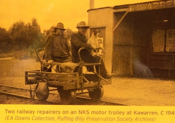
By the time I got back to Gellibrand I was well and truly ready for a rest, even though most of the trip returning from Beech Forest to Gellibrand was downhill. Originally I had planned to continue on to Kawarren, a few kilometres further north from Gellibrand, but as I needed a rest I figured I could leave that for another day. Tomorrow, perhaps?

More of Old Beechy. Wednesday 30/03
As I didn’t finish the Old Beechy Rail Trail yesterday I decided to continue riding it today. The section I rode was between Gellibrand and Barongarook. What a different trail it was to yesterday’s trail! It had some ups and downs between Gellibrand and Kawarren, and more or less followed the main road that connects Gellibrand and Colac on that section. But after Kawarren…


There was a major hill just out of Kawarren, and it was steep. So steep that I mostly walked up it. And then there was some welcome downhill, almost as steep (as I was to find out on the way back). The section between Kawarren and Birnam was not on the old railway alignment, probably because the railway alignment went through private land. So it followed an electric transmission line for a while and then went through some state forest.
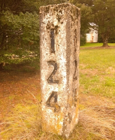
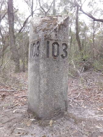
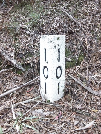
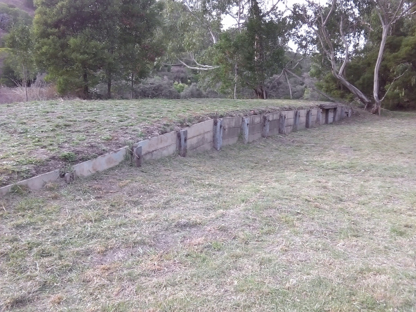
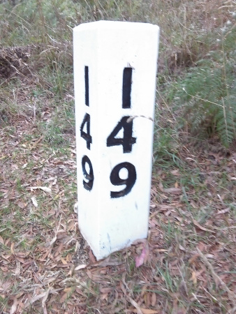
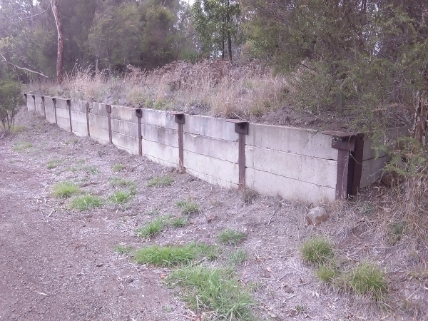
From Birnam, the trail was back on the railway formation, and was almost all the way from there to Barongarook. Along this section there was the remains of an old water tank that the trains used to refill their water, the 103 milepost, and some pretty major embankments spanning valleys and gullies. Eventually I reached Barongarook, and had a bit of a rest, a drink and some munchies to provide some fuel for the return ride. By this point I had ridden 16km, a large proportion of which was uphill.

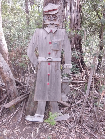
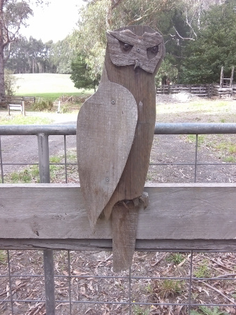
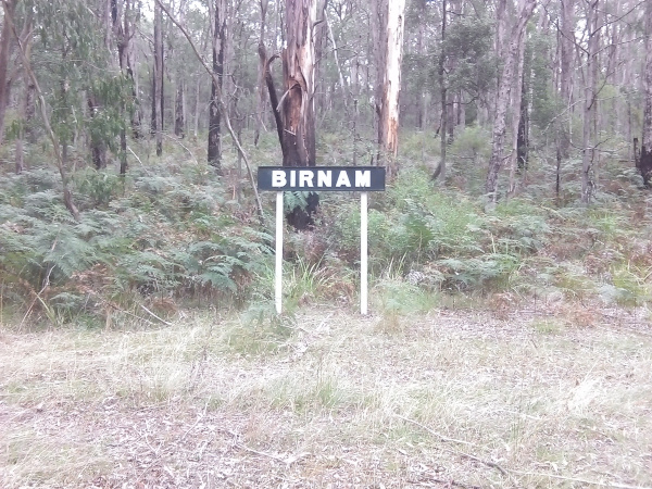
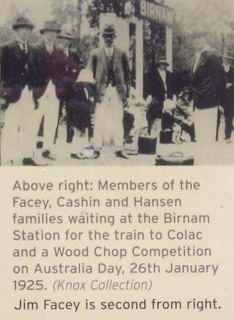
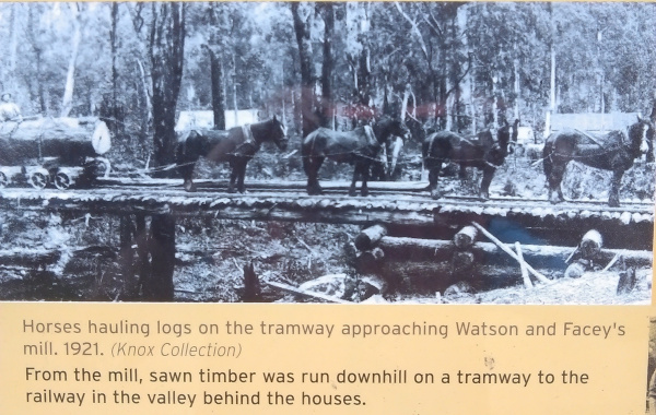
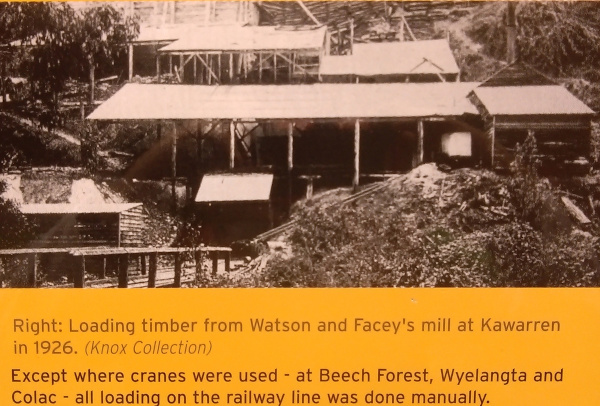
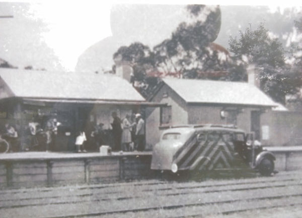
All along the trail sections of the Old Beechy Rail Trail there are interpretive signage. And on the way back from Barongarook I noticed two signs I missed from the other direction – one at Birnam which gave some history of the area including a siding that wasn’t, which served a sawmill that was for a number of years and then wasn’t. And some history about Birnam ‘station’. I trundled off in the direction of the ‘station’ and found the station sign, all that indicates where the ‘station’ once was.
Eventually I arrived back at Gellibrand, but not before the bike starting making some funny sounds when I went over some bumps. Not sure what it was, and a little apprehensive that maybe a bearing in the hub was going to fail or something else major, I continued on. Once at Gellibrand I found the culprit – it was just the back mud guard had worked it’s way loose and was sometimes rubbing on the tyre. After some adjustments it seemed to be better although I am thinking I might take the rear mud guard off all together.
Today’s ride took a bit less than 3 hours. And so by the time I got back to Gellibrand it was lunch time so I had some more munchies and some water, and a banana. Then I continued on to Fergusson, and visited two waterfalls – the Triplet falls, so named because there are 3 cascades; and Beauchamp Falls. Photos of those are on the Jims Life Log version of this post.
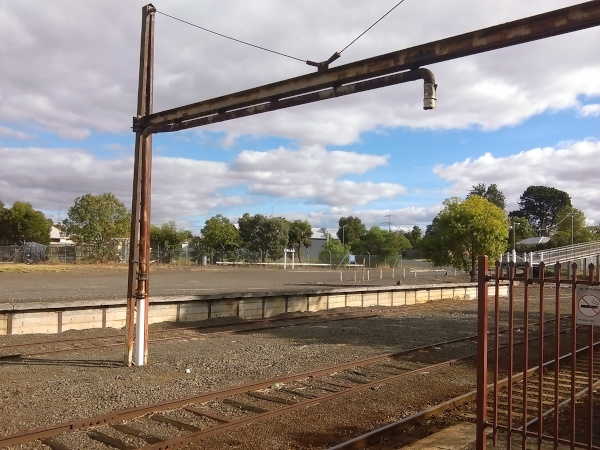
Then it was back to the Colac Otway Caravan Park where I am staying, to cook some dinner, etc. The campsite where I set up my tent has a very serene view over some paddocks. But during the day and sometimes at night there can be a fair bit of road noise as the Princes Highway, the major highway between Warrnambool and Melbourne, is on the other side of the park. And occasionally the sound of trains can be heard in the distance as they rumble between Melbourne and Warrnambool.

A Tiger, a waterfall, a volcano and some red rocks. Thursday 31/03
The itinerary, or plan thereof, for today was to ride the Tiger Rail Trail and explore around Forrest, then drive across to Cobden or Timboon and ride some of the Camperdown – Timboon Rail Trail, and on the way visit some more waterfalls. Here is how the day actually panned out…
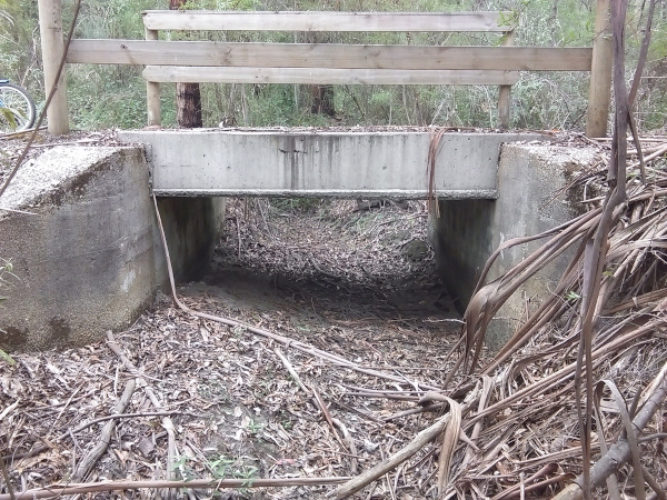
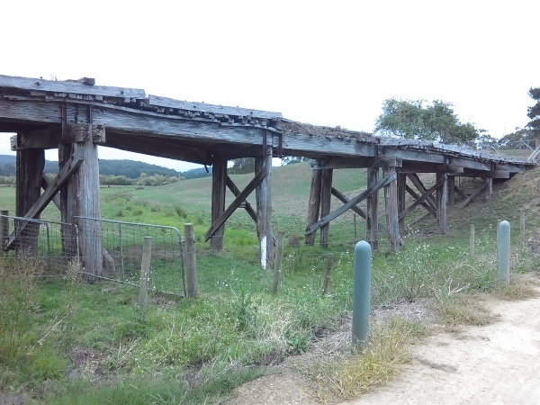
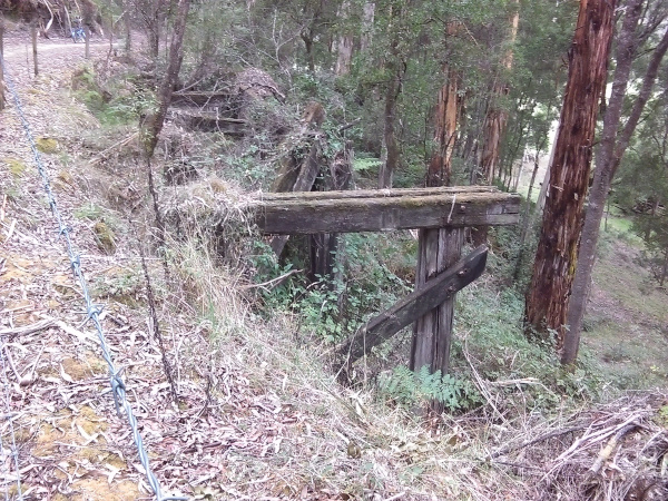
I rode the Tiger Rail Trail, located in and near Forrest, in Victoria. Forrest is a pleasant little town and the information board near the Caravan Park claims, probably very truthfully, that the town owes it’s existence to the railway. The railway to Forrest was a broad gauge (5′ 3”) railway, branching off the main Warrnambool line at Birregurra. The trail itself is only short, about 4 km, but it links up with the mountain bike trail network that surrounds Forrest. The trail was very pleasant to ride on, nice broad pathway, mostly very easy gradients. And there were some interesting historical elements along the way – 3 bridges, one of which is used by the trail, and the other two only remains of once load bearing bridges; a 101 milepost, and the site of an old station site not far from Forrest. The trail officially stops in the middle of no-where, but there is a steep trail up to the main road which can be used to continue on to Barwon Downs, or access the mountain bike trail network.


Once I had finished the Tiger trail, I took off the rear mudguard from the bike, and lo and behold, the terrible ‘bearing failing’ type noise I mentioned in yesterday’s section disappeared completely and so I went and explored the Barwon West Dam trails, most of which were mountain bike trails but the little K-Rock handled the trails I rode on without any problems. After some positively un-interesting lunch (baked beans, muesli bars, and a banana) at Forrest, and calculating how much petrol money and available day time I had left, I decided to head back to the caravan park. This was where the planned itinerary fell in a heap. After some sight-seeing, I headed back to the caravan park and went for a ride out to some volcanic features north / north west of Colac. On that ride I also spotted some long-disused railway embankments and cuttings on the way around Caragulac. But lost track of the right-of-way the closer I got to Alvie and the Red Rock Reserve. Tomorrow Cobden or Timboon or somewhere in between is the destination. Probably.
One more rail trail. Friday 01/04.
This was the last day of bike riding on this holiday. Tomorrow, Sabbath, I am going to be resting. And then on Sunday I make the long drive home, via Bendigo to have lunch with Zoe, Bec and Eliana as it’s Zoe’s birthday on that day.
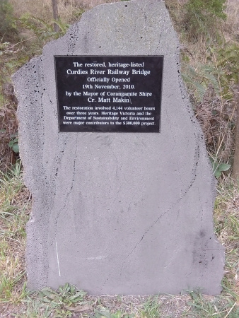
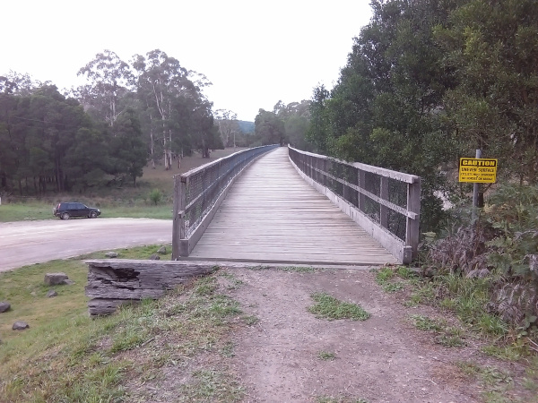
Today the plan was to ride as much of the Camperdown – Timboon Rail Trail as I could. Having acquired a gradient map, and as it would be better to have the dpwnhills on the way back to where I parked the car, I decided to park the car at Curdies River trestle bridge. From there it wsa uphill in any direction so I headed off to Timboon a leisurely 5km away. The Curdies river trestle bridge had been restored some years ago, and was great to ride across. It made a lot of wood clunking noises as I passed over the various planks but I didn’t think that was anything to worry about. Then after I got back to Curdies River I decided to head the other direction and ride as far as Glenfyne.
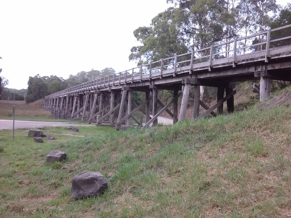
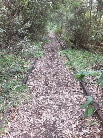
From Curdies River, the part of the trail that goes to Timboon, and the part of the trail that goes to Glenfyne are two very different beasts. Whereas the 5km section from Curdies River to Timboon is a quite wide nicely formed trail, the trail from Curdies River to Glenfyne is rather less well formed. On the latter section there are a number of trestle bridges which are not safe to go on, and as a result the trail winds it’s way down and up the other side whenever there is an unsafe trestle bridge. Those bits of trail were often narrow and/or steep and I found myself being very careful riding down, and often walking up while pushing the bike. There was also a section which had the rails and sleepers (ties, for those in the US) still in place which made that section somewhat bumpy and hollow sounding! I pondered why the rails would be left there while the rest of the trail has no rails or sleepers. Maybe it was because that section of the right-of-way was deemed inaccessible and so the rails and sleepers were simply left there.

I made it to Glenfyne, around 7km of mostly uphill from Curdies River, and proceeded back down the trail to Curdies River where the car was patiently waiting for me. Then I drove into Timboon and had some lunch which was about as ‘interesting’ as the lunch I have had out on the various trails all week – a mixture of bananas, apples, trail mix (how appropriate), and ‘up-and-gos’ (a liquid breakfast beverage). Then I drove up to Glenfyne.
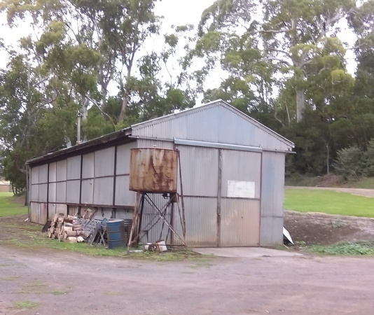
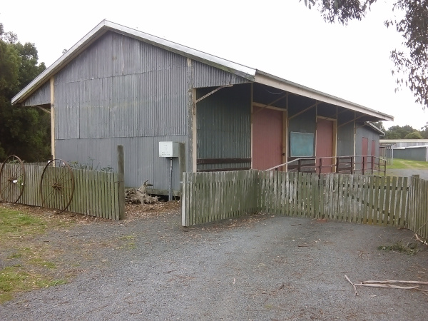
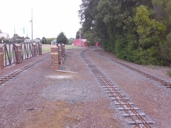
Once I had parked the car at Glenfyne I hopped on the bike and rode towards Cobden. And again, a headwind. A pretty fierce one too. Are those headwinds getting stronger?? At least I would have a tailwind on the way back! This section of the trail is not quite as interesting as the sections I rode earlier in the day, but it also wasn’t as steep which was a welcome change. At Cobden I found the the old railway goods shed, which is right next to the Cobden Miniature Railway – a good reason to come back to this part of the world! For the whole day I rode about 45km which either is a record or close to record number of kilometres I have ridden in a day on the K-Rock Foldable bike.
Then an hour’s drive from Glenfyne and I was back at camp. Time to relax.