Cycling Holiday Day 4 – M2MRT – Wangaratta – Beechworth
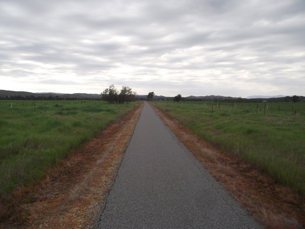
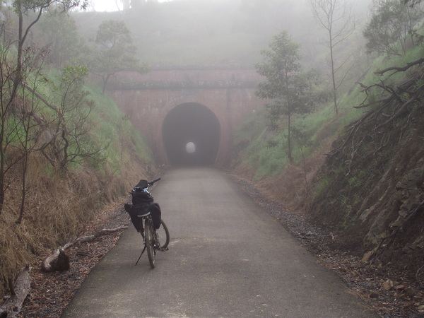
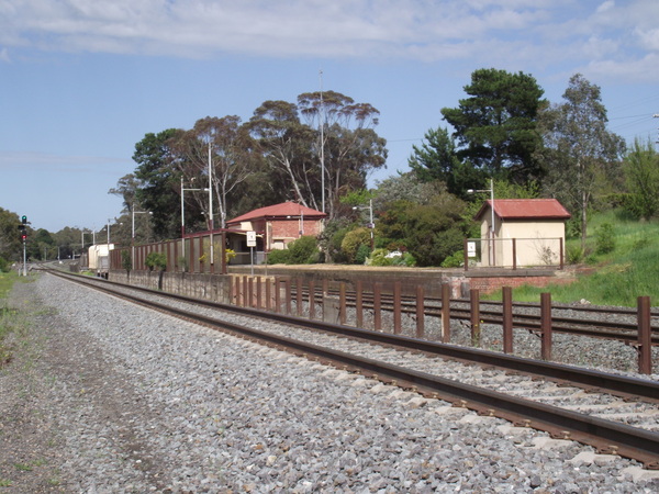
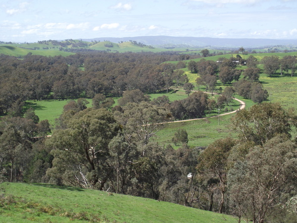
One thing became quickly apparent upon arrival at my accommodation at Wangaratta – it is much more noisy than Bonnie Doon. Bonnie Doon was very quiet and serene (yes, I could feel the serenity). Wangaratta is all hustle bustle. Wangaratta is a much much bigger town than Bonnie Doon and I guess that accounts for the increased noise levels.Today I tackled the Wangaratta to Beechworth rail trail, which I thought would be hard even before I rode it as everything I read suggested to ride from Beechworth towards Wangaratta, not the direction I went. There has to be a reason for that ‘suggestion’…
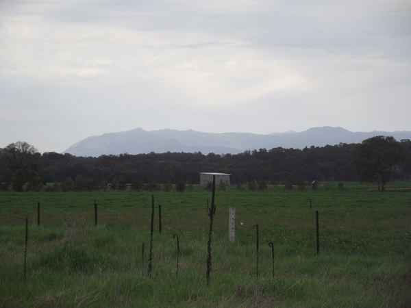
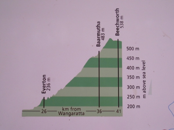
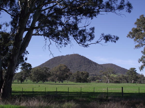
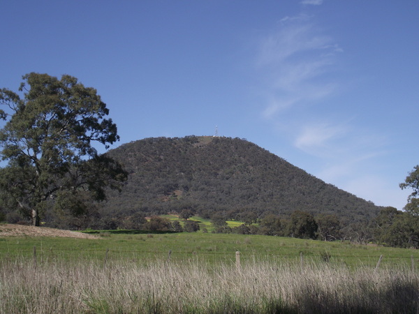
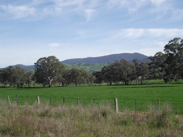
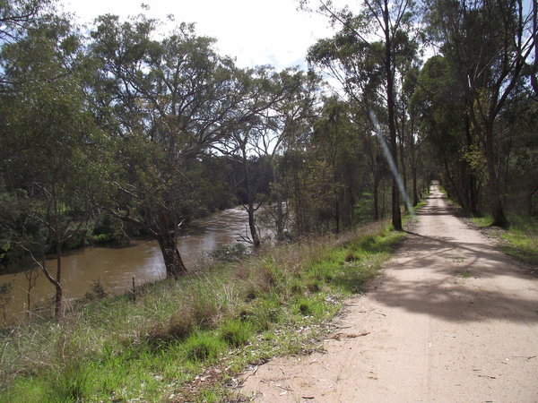
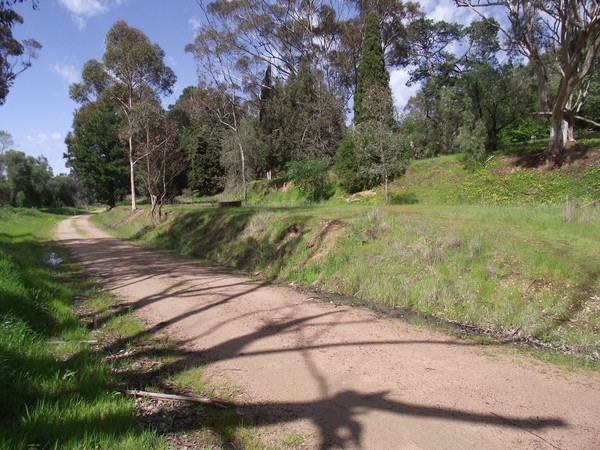
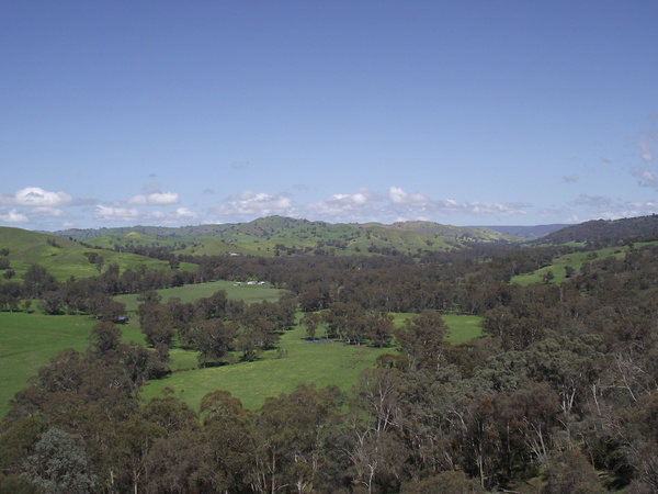
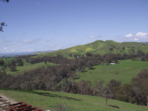
The section between Wangaratta and Everton was pleasant enough – fairly open country, not many steep or long hills, fairly flat generally. But the Everton – Beechworth section was another thing altogether – it was looong and steeep. It wasn’t as open country as the Merton Gap section of the Goulburn Valley High Country Rail Trail I rode a few days ago and there were NO magpies, but comparing Merton Gap and Everton – Beechworth tracks I would have to say they both were hard going. I think the Everton – Beechworth track was a little harder, just because of the steepness of the ascent and how long and relentless it was. I was really counting down the kilometres from about 1/2 way between Everton and Beechworth.
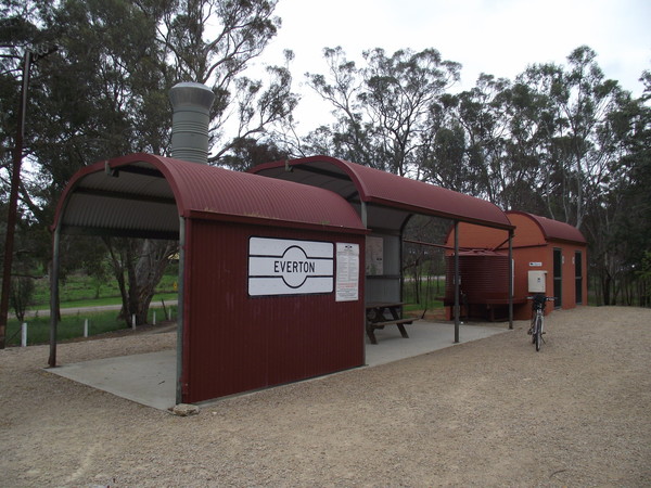
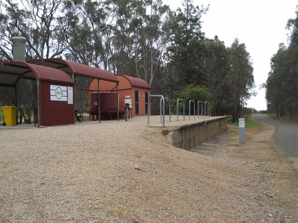
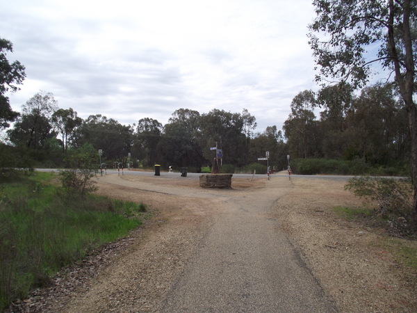
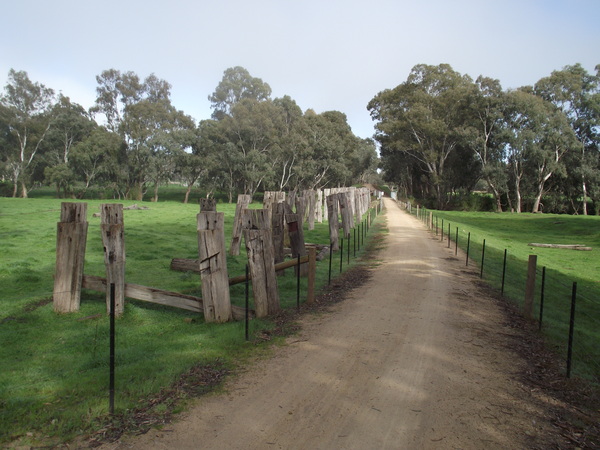
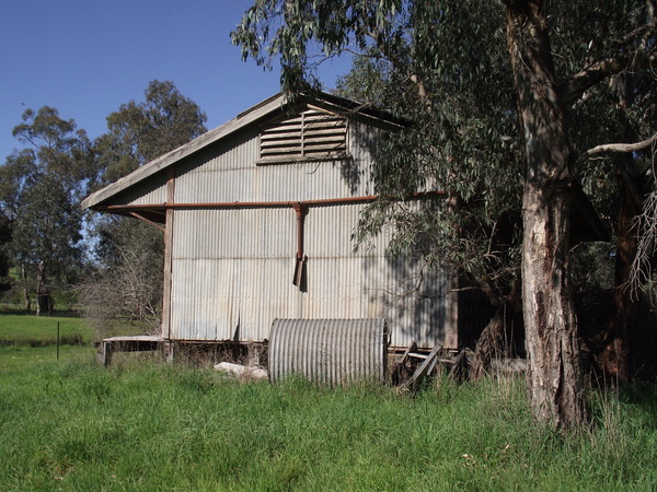
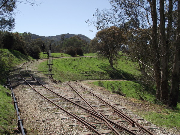
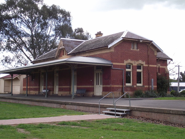
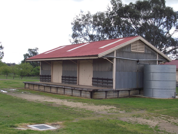
I didn’t take many photos of today’s ride, as I was doing this day’s ride specifically to see if I could reach Beechworth. Which I eventually did. I did take a few photos including some of the Everton rest stop, which is at the junction of the Wangaratta – Bright and Everton – Beechworth rail trail. So here are the best of the photos I took for the day.
I didn’t take any photos between Everton and Beechworth. Not because the scenery didn’t warrant it, but because I really didn’t want to have to stop on the grade and have to build up my speed again. Maybe if I ride it from Beechworth to Everton one day then I will take some time to take some photos.
So that ends my 4 day cycling adventure, and here I am sitting at home typing up my last blog entry for the trip. Total distance travelled was around 160km – not bad for 4 days. So now it’s time to take a little break from my bike riding, but only until the weekend when I try a ride closer to home.
GPS tracking for today’s ride can be seen here:
Cycling Holiday Day 3 – GVRT – Bonnie Doon – Mansfield
Being quite tired from yesterday’s ride, I was in bed and asleep by about 8pm. And I slept well, waking at about 5:45am today. The shoulder / neck muscles were still a bit sore but I felt more mentally ready to tackle today’s ride than I did before yesterday’s ride. The ride was only 22km, which is about 1/3 of the distance I covered yesterday and shorter than most of the rides I do around home.
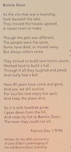
The Bonnie Doon township also has an interesting history. One of the most moving events was when the size of lake Eildon was increased. I don’t mean moving as in emotional, although it might have been for the locals in 1955 when it happened. I mean the town was literally moved. In 1955, while the moving of the town to higher ground was still underway, heavy rains in the catchment areas caused a rapid rise in water level which covered many landmarks from the pioneering days including the Wappan Station and the Commercial Hotel. In 1996, a Patricia Day commemorated the move in a poem.
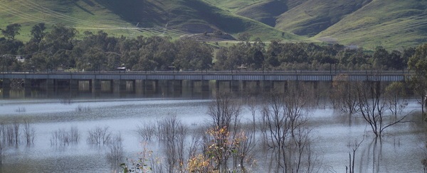
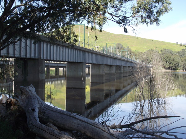
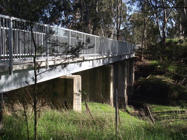
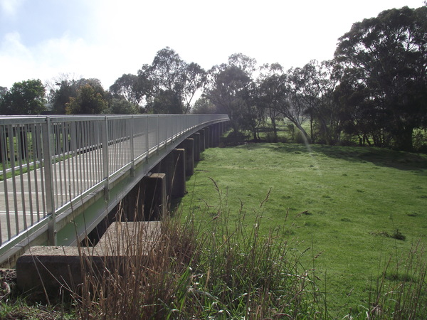
To get to Mansfield from Bonnie Doon requires crossing Lake Eildon. On the rail trail this means using the old railway bridge which has been converted to cycling / walking bridge. While I rode across all the other bridges on this ride, I decided to walk across the Bonnie Doon bridge. The fencing looked not quite high enough for my liking, and I didn’t like the idea of plunging into the lake bike and all if for some reason I hit the fencing. That might seem like I had a lack of confidence in my own cycling ability but I have only ever had one cycling accident, and a fairly minor one at that. It’s probably just an example of me being extra careful, after all I wasn’t riding with anyone else so if I did happen to have an accident probably no-one would have known where I was.
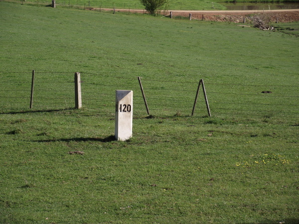
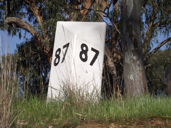
A few kilometres after the bridge I went past the 120 milepost. That means 120 miles from Melbourne. And when I stopped to take a photo I got swooped by a magpie. Not that swooping magpies was a rarity – actually I lost count of the amount of times I got swooped. But I am beginning to wonder whether stopping, or slowing down, actually causes the magpies to be more vicious in their attacks. The 120 milepost was approaching to top of the only major grade on the hill, which culminated at Hangmans Hill.
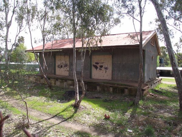
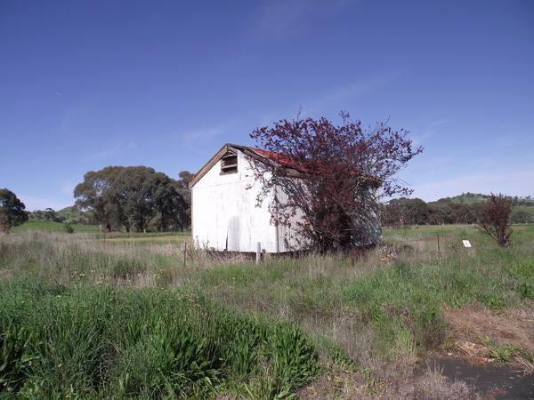
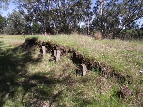
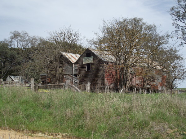
There is really only one historial point of interest on the next section of the trail – Maindample. Maindample probably owes it’s existence initially to the discovery of gold in the area. Today it is mostly a wayside stop on the way to Mansfield and beyond. In 1867 there were numerous gold reefs found, but apparently no alluvial gold. The gold boom in Maindample was short lived, but even as late as the mid 1880’s some miners were still trying to coax gold out of the Try Again Reef. The township was officially surveyed in 1875. I remember seeing the railway goods shed from the road on numerous occasions when travelling through, but this was the first time I had seen the goods shed up close. It is quite a different style to the other existing goods sheds on the trail. Don’t ask me why, I am only making the observation.
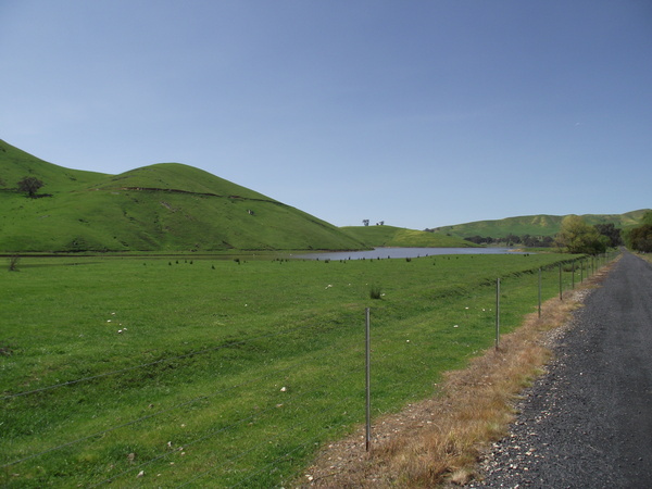
The scenery along this section of the trail is open farm country, and very pleasant on the eyes. The further away from the main roads the trail is, the more tranquil it gets, except when the magpies dive bombed, then it was a matter of peddle frantically, or stop quickly and walk backwards keeping an eye on it. In the distance to the east Mt Samaria (I think) can be seem, to the north is open farmland, to the south is some hills known as The Paps. Whenever I hear the name ‘The Paps’, or see the mountains it reminds me of Biblical references to being ‘girt about the paps’ (KJV) and I wonder whether the person who named them was making some sort of allusion to what the Bible calls ‘the paps’.
I arrived at Mansfield about 9:45am, and waited for Rebecca to pick me, then the plan was to travel around the mountain ranges to Wangaratta by car, where I am staying tonight, so I can do the climb to Beechworth tomorrow. But while we were having lunch at Mansfield 2 ambulances and Police car sped down the road we were planning to take so we head up and over the range via Tolmie and Whitfield instead. The rail trail to Beechworth starts almost at the front door of the motel where I am staying. I have off-loaded as much luggage as I can so I can tackle the climb to Beechworth with less weight as the trail is about 40km long, and apparently quite steep after Everton. I hope it’s not as steep as the Merton Gap climb from yesterday, but I suspect it will be.
To see the GPS tracking for this ride, go to:
Cycling Holiday Day 2 – GVRT – Yea – Bonnie Doon
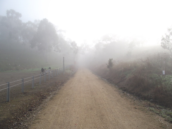
Buying that packet of ‘Shapes’ savory biscuits that was on sale was not a good idea! I had a funny stomach most of the night and had to visit the ‘porcelain bus’ a few times to empty the bowels. And inspite of the 40km ride yesterday, I didn’t sleep very well. So I started getting ready about 6am, planning to depart Yea at 7am. When I left there was a fairly thick fog, but once I got through the Cheviot tunnel, about 9km from Yea, the sky was clear. There was a threatening sky around Molesworth, with banks of cloud rolling through the valley, but about 30 minutes later the sky was clear blue and it styed that way until Bonnie Doon.
The ride from Yea to the Cheviot Tunnel was across the Yea River flats, and so there were a lot of bridges. And then the climb to the tunnel began, which wasn’t as hard as I thought it would be but it was hard enough. The Cheviot Tunnel is one of the key features of the Goulburn Valley rail trail. It was (is) the only tunnel on the line / trail and was made using handmade bricks made from local clay. The tunnel is 201 metres (660 feet) long and is the longest rail tunnel in Victoria, although whether you would still call it a ‘rail’ tunnel could be debated as no railway runs through it today, only the rail trail. It is estimated that there are approximately 657,000 bricks in the tunnel.
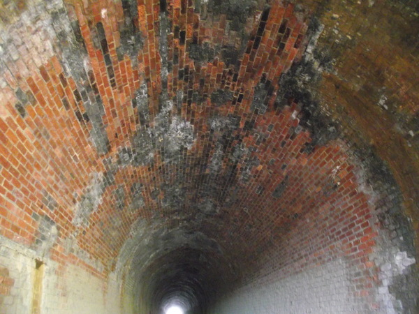
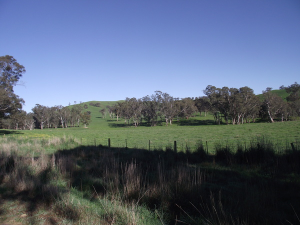
Cheviot Tunnel marked a major cycling milestone for me: 500km in a calendar month (so far). The scenery so far on this cycling holiday has really been ‘good for the soul’. Around Trawool is very beautiful, but east of Yea is also beautiful. Here are a few pictures of scenery between Cheviot Tunnel and Molesworth.
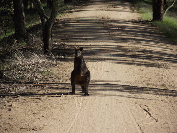
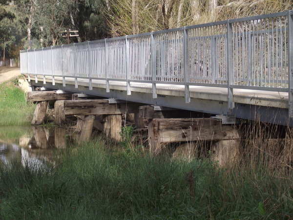
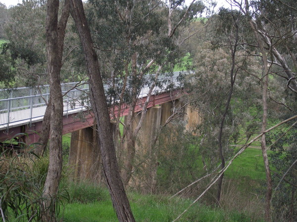
After the tunnel, there was a pleasant down grade for quite a way, and a bridge (or more, I can’t remember) across creeks. Harvey’s Gully is in this area and was the scene of a derailment in 1911, and the picture I saw of it showed part of the train on the bridge and part of the train in the gully and the locomotive looks like it is upsidedown. I don’t know whether the picture of the bridge below are the Harvey Gully bridge, as the approaches to the gully in the 1911 photo I saw of the bridge looks quite different to the photo below. Also in the near vicinity was a concrete milepost, and a wallaby.
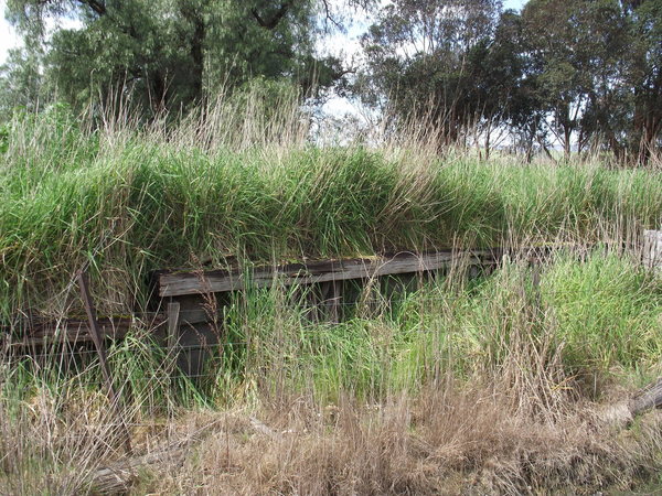
Molesworth Station area is now a car park, and had one iddy biddy section of track, which I assume is on the original alignment as it points in what appears to be the right direction.
Just to the east of Molesworth, the trail crosses the Goulburn River flats on a number of bridges. The two longest ones had concrete supports when the railway line closed, and some of the others were timber trestle bridges.
Cathkin, like so many other places that had stations when the railway operated, was little more than a few mounds of dirt and the occasional ‘evidence’ of there being a railway in the area. This location was where the branch line to Alexandra diverged, and apparently was quite a busy place when trains were split – 1/2 the train going to Alexandra and the other 1/2 going to Mansfield. I did see evidence of a web designer there…
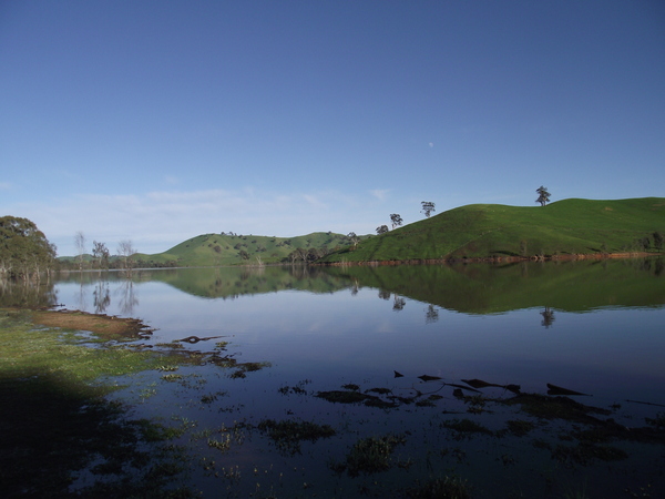
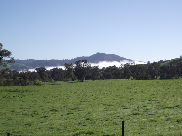
Yarck and Kanumbra came and went, then it was the hard climb to the highest point on the trail – the Merton Gap, at 397 metres above sea level. The climb was long, and most of it I was using the lower gears on the bike. And just when I thought is was about to end, it just kept on going. Man, it was tough! But I eventually got to the top, and then it was a rather pleasant down grade to Merton, where I stopped to buy a fruit juice (Banana and Mango). I wish I hadn’t purchased the drink as after I drank it my energy levels seemed lower than they were before. Or maybe it was just that the climb to Merton Gap had used a lot of my energy reserves. Whatever the reason I found it hard going for the next 15km to Bonnie Doon. The scenery approaching Bonnie Doon was, well, rather than use an adjective to describe it why don’t I just show you the pictures…
That brought the day’s ride to 62km. I guess I have a certain right to not have much energy after a ride like that!
A great, if somewhat tiring, ride! I would do it again, but not in Spring (swooping magpies gets a bit on the nerves after a while) and would probably not do it while wearing a pack on my back as my shoulders were getting pretty sore by the end of the ride.
For GPS tracking of todays ride, see:
Cycling Holiday Day 1 – GVRT Tallarook – Yea
I woke up this morning to the sound of rain, and by the time we were passing through Albury / Wodonga the rain had that menacing ‘raining all day’ look about it. But the further south we got, the better the weather got and by the time we arrived at Tallarook the day was warm, and sunny, with a little cloud. Perfect weather for cycling!As I removed the bike from the bike rack on the back of the car, there was a magpie stuka that was swooping Rebecca and the kids, but it seemed to be content to leave me alone, so while I got the bike set up to start my trek, the rest of the family retreated to the car.
I had never been to Tallarook, or travelled on the road from there to Trawool, before today so that was a new experience. Tallarook was once the junction for the Mansfield and Alexandra railway lines. Parts of the rail trail are adjacent to the Goulburn River and the grades, being old railway formations tended to be up to about 4% (1:25).
Then at the end of Goulburn River Road, the trail follows the Goulburn Valley Highway towards Yea. There were a number of old railway station / siding locations, which basically showed very little evidence of being an important railway formation, and often the signage was the only real proof that a railway facility (apart from the track) was even there, as at Trawool.
At Granite, where there was once a station but today the overwhelming feature is the Trawool Valley Resort (I think that is the name of it).
A few kilomtres further on was Kerriesdale. At this point in the journey I decided to visit the Kerriesdale Mountain Railway (KMR), a privately owned and operated tourist railway that has a maximum grade of 1:12 (around 8%). The grades reminded me of photos I had seen of the Cass Railway in West Virginia, but the surrounds had a lot less trees.
The views from the Summit and along the journey to the Summit were amazing. The location on the railway called Strath View Siding offered views to the east towards the Australia Alps, and from the Summit the view was nearly 360 degrees with magnificent views into the valleys and mountains beyond! If you are ever in the Trawool area, I would say the the KMR is a ‘must visit’ location. And I am not just saying that because I like trains!
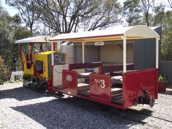
After riding the train to the summit and back we arrived back at the Bottom Points station, where I had some lunch. Then I gingerly descended to the rail trail (the road to / from the Kerriesdale Mountain railway was so steep I had to walk the bike up the last section on the way to get to the KMR), and had to navigate through the scrub for a little way to get back on the rail trail – not ideal when riding a portable bike. And then I continued towards Yea.
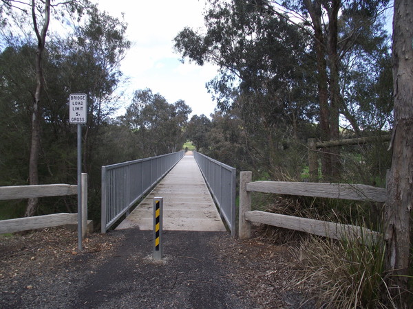
Not long after I got back on the rail trail at Kerriesdale, I passed over the King Parrot Creek Bridge. This is a fairly high bridge – I am thinking it is probably the second highest on the whole trail, the one over Lake Eildon being higher – but there may be others that I am not aware of. I wasn’t aware of their being a rather long tunnel on the rail trail either until I read about it a week or so ago, so there may be other high bridges I am not aware of too. Also in the area near the King Parrot Creek bridge, there are some old growth River Red Gum forests, which apparently have some trees up to 600 years old.
At Homewood, there was very little evidence of the railway station that once existed. But I did find this:
There were a number of long-ish grades on the section between Kerriesdale and Yea, but apart from a swooping magpie actually attacking my helmet (a first since I painted it black and added heaps of cable ties) the whole journey from Tallarook to Yea was without any major incident.
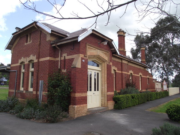
Upon arrival at Yea I had a look around the well preserved railway station and good shed, and then headed off to the motel where I was booked to spend the night.
Over all a very enjoyable and interesting ride.
For GPS tracking for this ride, go to :